Το Αντίβαρο σας παρουσιάζει ολόκληρη την Συνθήκη Ειρήνης Βουκουρεστίου το 1913

Αυτή για την οποία μας έχουν πρήξει τα συκώτια ότι δήθεν «μοίρασε την Μακεδονία σε τρία (ή τέσσερα) κράτη, με την Ελλάδα να έχει το 51%, την Γιουσκοσλαβία το 38%, την Βουλγαρία το 10% και την Αλβανία λιγότερο από το 1%».
Αυτό δεν λένε;
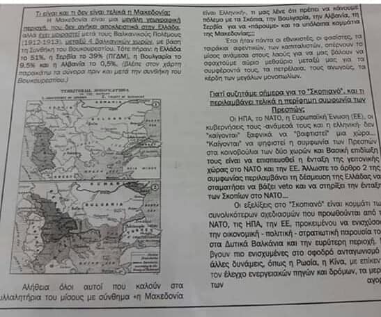
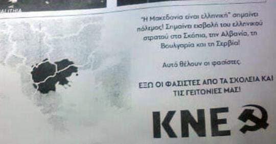
Το λέει ο (τέως) υπουργός εξωτερικών Νίκος Κοτζιάς, το λέει ο πρωθυπουργός Αλέξης Τσίπρας (μαζί με την Μπακογιάννη και τον Μπουτάρη), το λέει ο Τζανακόπουλος, το λένε υπουργοί του ΣΥΡΙΖΑ (εδώ και εδώ), το λέει ο Ριζοσπάστης, το λέει ο 902, o Μπογιόπουλος, το λέει το ΚΚΕ στα φυλλάδια που μοιράζει στα σχολεία (φωτο 1, φωτο 2, φωτο 3), το λέει η Εφημερίδα των Συντακτών, to Documento, το λέει ο Μαυρίδης του liberal.gr, το λέει η Καθημερινή (ως εφημερίδα), το γράφει σε blog του Πρώτου Θέματος, το λένε καθηγητές πανεπιστημίου (στην Αυγή, στο Στο Κόκκινο, στο Κουτί της Πανδώρας), το γράφουν στα ελληνικά πανεπιστήμια (Μάστερ στο Παν. Μακεδονίας), το λέει η εγγονή του Τίτο, διάφοροι (εδώ, εδώ, εδώ, εδώ, εδώ). Το λέει εμμέσως και ο υπ. εξ. των Σκοπίων Δημητρώφ. Το λένε λίγο-πολύ όλοι.
Εμείς, στο Αντίβαρο, το αμφισβητούμε. Το ίδιο κάνουν και οι εξής: ο Σάββας Καλεντερίδης, ο Γιώργος Ρωμανός, οι Ακτίνες, οι Χρονογραφίες, και άλλοι.
Παραθέτουμε ολόκληρη την Συνθήκη Ειρήνης του Βουκουρεστίου στα ελληνικά (από τον ιστοχώρο του ΓΕΕΘΑ). Στον ακόλουθο σύνδεσμο θα την βρείτε και στα αγγλικά (στο scribd). Κατεβάστε την στα ελληνικά από εδώΑυτό δεν λένε;
Το λέει ο (τέως) υπουργός εξωτερικών Νίκος Κοτζιάς, το λέει ο πρωθυπουργός Αλέξης Τσίπρας (μαζί με την Μπακογιάννη και τον Μπουτάρη), το λέει ο Τζανακόπουλος, το λένε υπουργοί του ΣΥΡΙΖΑ (εδώ και εδώ), το λέει ο Ριζοσπάστης, το λέει ο 902, o Μπογιόπουλος, το λέει το ΚΚΕ στα φυλλάδια που μοιράζει στα σχολεία (φωτο 1, φωτο 2, φωτο 3), το λέει η Εφημερίδα των Συντακτών, to Documento, το λέει ο Μαυρίδης του liberal.gr, το λέει η Καθημερινή (ως εφημερίδα), το γράφει σε blog του Πρώτου Θέματος, το λένε καθηγητές πανεπιστημίου (στην Αυγή, στο Στο Κόκκινο, στο Κουτί της Πανδώρας), το γράφουν στα ελληνικά πανεπιστήμια (Μάστερ στο Παν. Μακεδονίας), το λέει η εγγονή του Τίτο, διάφοροι (εδώ, εδώ, εδώ, εδώ, εδώ). Το λέει εμμέσως και ο υπ. εξ. των Σκοπίων Δημητρώφ. Το λένε λίγο-πολύ όλοι.
Εμείς, στο Αντίβαρο, το αμφισβητούμε. Το ίδιο κάνουν και οι εξής: ο Σάββας Καλεντερίδης, ο Γιώργος Ρωμανός, οι Ακτίνες, οι Χρονογραφίες, και άλλοι.
Όπως βλέπουμε όλοι δεν υπάρχει πουθενά ο όρος Μακεδονία. Υπάρχουν σε αρκετά άρθρα ονομασίες περιοχών που καθορίζουν τα σύνορα, αλλά πουθενά ο όρος Μακεδονία.
Η Οθωμανική Αυτοκρατορία ποτέ δεν χρησιμοποίησε τον όρο Μακεδονία για να ονομάσει οποιαδήποτε περιοχή. Χρησιμοποιούσε διοικητικές περιοχές που ονόμαζε Βιλαέτια. Υπήρχε έτσι το Βιλαέτι Θεσσαλονίκης, Μοναστηρίου, Αδριανούπολης.
Ακολουθούν δύο επίσημοι χάρτες από την έκθεση μίας Διεθνούς Επιτροπής, η οποία συστήθηκε μετά τη λήξη των Βαλκανικών πολέμων. (εδώ το βιβλίο Report of the International Commission to Inquire into the Causes and Conduct of the Balkan Wars). Ο πρώτος χάρτης δείχνει τα σύνορα του παλαιότερου συνεδρίου του Λονδίνου και το δεύτερος χάρτης δείχνει ακριβώς τα σύνορα μετά την Συνθήκη Ειρήνης του Βουκουρεστίου. Προσέξτε πού γράφει Μακεδονία. Οι ίδιοι χάρτες υπάρχουν και εδώ

Ο ίδιος ακριβώς χάρτης υπάρχει και στην διεθνή έκδοση της Wikipedia για την εν λόγω συνθήκη.
Προσέξτε τώρα και την πόλη Uskub μεταξύ του Ι και του Α από τη λέξη SERVIA. Uskub είναι η Οθωμανική εκδοχή της πόλης των Σκοπίων. Μάλιστα, τα Σκόπια όχι μόνο δεν ήταν μέρος της Μακεδονίας, όχι μόνο δεν ανήκαν σε κανένα από τα τρία Βιλαέτια, των οποίων τα εδάφη μοιράστηκαν, όχι μόνο δηλαδή ανήκαν σε άλλο Βιλαέτι, στο Βιλαέτι του Κοσσυφοπεδίου, αλλά από το 1888 ως το 1914, ήταν η πρωτεύουσα του Βιλαετίου του Κοσσυφοπεδίου (δείτε το εδώ)!. Ως συμπέρασμα, άνω του 85% του πληθυσμού της πΓΔΜ κατοικεί σήμερα εκτός της περιοχής των τριών Βιλαετίων.
Συνεπώς
- ψεύδος ότι η Συνθήκη του Βουκουρεστίου αναφέρεται στην Μακεδονία
- ψεύδος ότι η Συνθήκη του Βουκουρεστίου μοίρασε την Μακεδονία σε 3 ή 4 χώρες
- ψεύδη τα ποσοστά που αναφέρονται συνήθως
- ψεύδος ότι η περιοχή της πΓΔΜ ανήκει σε κάποια έννοια μίας ευρείας περιοχής της Μακεδονίας. Ουδέποτε υπήρξε τέτοια διοικητική περιοχή επί Οθωμανικής Αυτοκρατορίας. Έναν χάρτη με Οθωμανική διοίκηση περί «Μακεδονίας» δεν έχουν βρει ακόμη.
- μόνο το πολύ νότιο τμήμα της πΓΔΜ, δηλαδή η περιοχή γύρω από το Μοναστήρι και τις πόλεις Αχρίδα, Αντιγόνεια, Δίβρη και Άστιβος. Μόνο αυτές οι πόλεις, οι οποίες μάλιστα φέρουν και ελληνικά ονόματα, ανήκαν στην περιοχή της Μακεδονίας. Σημειώνεται ότι βάσει της Συμφωνίας των Πρεσπών, υποχρεωνόμαστε να παύσουμε να χρησιμοποιούμε τα ελληνικά ονόματα γι’ αυτές τις πόλεις! Θα πρέπει να χρησιμοποιούμε τα «μακεδονικά» (κατά την Συμφωνία) ονόματα, δηλαδή Μπίτολα, Οχρίντ, Νεγκότινο, Ντέμπαρ, Στιπ.
- Η Ελλάδα από το 1912-13 που απελευθέρωσε τα εδάφη της Μακεδονίας, αμέσως τα ονόμασε επισήμως Μακεδονία, όπως και ήταν. Η Γιουγκοσλαβία για 30 χρόνια δεν χρησιμοποιούσε αυτό το όνομα. Μόνο το 1943-44 άρχισε να το χρησιμοποιεί. Η Βουλγαρία δε καθόλου, ούτε και σήμερα.
Ολόκληρη η Συνθήκη του Βουκουρεστίου στα αγγλικά [Αντιγραφή από site Σκοπιανών] με παραπομπές στους επίσημους χάρτες της Συνθήκης.
Peace Treaty between Roumania, Greece, Montenegro, Serbia and Bulgaria.THEIR MAJESTIES the King of Roumania, the King of the Hellenes, the King of Montenegro, and the King of Serbia, on the one part, and His Majesty the King of the Bulgarians, on the other part, animated by the desire to put an end to the state of war at present existing between their respective countries and wishing, for the sake of order, to establish peace between their long-suffering peoples, have resolved to conclude a definitive treaty of peace. Their said Majesties have, therefore, appointed as their plenipotentiaries, namely:His Majesty the King of Roumania: His Excellency Titus Maioresco, President of his Council of Ministers, Minister of Foreign Affairs; His Excellency Alexander Marghiloman, his Minister of Finance; His Excellency Take Jonesco, his Minister of the Interior; His Excellency Constantin G. Dissesco, his Minister of Public Worship and Public Instruction; Major-General C. Coanda, Aide-de-camp, Inspector-General of Artillery; Colonel C. Christesco, Assistant Chief of the General Staff of his Army;His Majesty the King of the Hellenes: His Excellency Elefterios Venizelos, President of his Council of Ministers, Minister of War; His Excellency Demetre Panas, Minister Plenipotentiary; M. Nicolas Politis, Professor of International Law in the University of Paris; Captain Ath. Exadactylos; Captain C. Pali;His Majesty the King of Montenegro: His Excellency General Serdar Yanko Voukotitch, President of his Council of Ministers, Minister of War; M. Jean Matanovitch, formerly Charge d’Affaires of Montenegro at Constantinople;His Majesty the King of Serbia: His Excellency Nicolas P. Pasitch, President of his Council of Ministers, Minister of Foreign Affairs; His Excellency Milhailo G. Ristitch, his Envoy Extraordinary and Minister Plenipotentiary at Bucharest; His Excellency Dr. Miroslaw Spalaikovitch, Envoy Extraordinary and Minister Plenipotentiary; Colonel K. Smilianitch; Lieutenant-Colonel D. Kalafatovitch;His Majesty the King of the Bulgarians: His Excellency Dimitri Tontcheff, his Minister of Finances; Major-General Ivan Fitcheff, Chief of Staff of his Army; M. Sawa Ivantchoff, Doctor of Laws, formerly Vice-President of the Sobranje; M. Simeon Radeff; Lieutenant-Colonel Constantin Stancioff of the General Staff;Who, in accordance with the proposal of the Royal Government of Roumania, have assembled in conference at Bucharest, with full powers, which were found to be in good and due form, and who having happily reached an accord, have agreed upon the following stipulations:-I.From the day on which the ratifications of the present treaty are exchanged there shall be peace and amity between His Majesty the King of Roumania, His Majesty the King of the Bulgarians, His Majesty the King of the Hellenes, His Majesty the King of Montenegro, and His Majesty the King of Serbia, as well as between their heirs and successors, their respective States and subjects.II.The former frontier between the Kingdom of Bulgaria and the Kingdom of Roumania, from the Danube to the Black Sea, is, in conformity with the proces-verbal drawn up by the respective military delegates and annexed to Protocol No.5 of July 22 (August 4), 1913, of the Conference of Bucharest, rectified in the following manner:-The new frontier shall begin at the Danube above Turtukaia and terminate at the Black Sea to the south of Ekrene.Between these two extreme points the frontier line shall follow the line indicated on the I/ 100,000 and I/200,000 maps of the Roumanian General Staff, and according to the description annexed to the present article.It is formally understood that within a maximum delay of two years Bulgaria shall dismantle the existing fortifications and shall not construct others at Rustchuk, at Shumla, in the intervening country, and in a zone of twenty kilometres around Baltchik.A mixed commission, composed of an equal number of representatives of each of the two High Contracting Parties, shall be charged, within fifteen days from the signing of the present treaty, with delimiting the new frontier in conformity with the preceding stipulations. This commission shall supervise the division of the lands and funds which up to the present time may have belonged in common to districts, communes, or communities separated by the new frontier. In case of disagreement as to the line or as to the method of marking it, the two High Contracting Parties agree to request a friendly Government to appoint an arbitrator, whose decision upon the points at issue shall be considered final.III.The frontier between the Kingdom of Bulgaria and the Kingdom of Serbia shall follow, conformably to the proces-verbal drawn up by the respective military delegates, which is annexed to Protocol No.9 of July 25 (August 7), 1913, of the Conference of Bucharest, the following line:-The frontier line shall begin at the old frontier, from the summit of Patarica, follow the old Turco-Bulgarian frontier and the dividing line of the waters between the Vardar and the Struma, with the exception of the upper valley of the Strumitza, which shall remain Serbian territory; the line shall terminate at the Belasica Mountain, where it will bend back to the Greco-Bulgarian frontier. A detailed description of this frontier and the I/200,000 map of the Austrian General Staff, on which it is indicated, are annexed to the present article.A mixed commission, composed of an equal number of representatives of each of the two High Contracting Powers, shall be charged, within fifteen days from the signing of the present treaty, with delimiting the new frontier, in conformity with the preceding stipulation.This commission shall supervise the division of the lands and funds, which up to the present time may have belonged in common to the districts, communes, or communities separated by the new frontier. In case of disagreement as to the line or as to the method of marking it, the two High Contracting Parties agree to request a friendly Government to appoint an arbitrator, whose decision upon the points at issue shall be considered final.IV.Questions relating to the old Serbo-Bulgarian frontier shall be settled according to the understanding reached by the two High Contracting Parties, as stated in the protocol annexed to the present article.V.The frontier between the Kingdom of Greece and the Kingdom of Bulgaria shall follow, conformably to the proces-verbal drawn up by the respective military delegates and annexed to Protocol No.9 of July 25 (August 7), 1913, of the Conference of Bucharest, the following line:-The frontier line shall start from the new Serbo-Bulgarian frontier on the summit of Belasica Planina and terminate at the mouth of the Mesta on the Aegean Sea.Between these two extreme points the frontier line shall follow the line indicated on the I/200,000 map of the Austrian General Staff, in accordance with the description annexed to the present article.A mixed commission, composed of an equal number of representatives of each of the two High Contracting Parties, shall be charged, within fifteen days from the signing of the present treaty, with delimiting the frontier in conformity with the preceding stipulations.This commission shall supervise the division of the lands and funds, which up to the present time may have belonged in common to the districts, communes, or communities separated by the new frontier. In case of disagreement as to the line or as to the method of marking it, the two High Contracting Parties engage to request a friendly Government to appoint an arbitrator, whose decision upon the points at issue shall be considered final.It is formally understood that Bulgaria renounces from henceforth all claim to the island of Crete.VI.The headquarters of the respective armies shall be immediately informed of the signing of the present treaty. The Bulgarian Government engages to begin to reduce its army to a peace footing on the day after such notification. It shall order its troops to their garrisons, whence, with the least possible delay, the various reserves shall be returned to their homes.If the garrison of any troops is situated in the zone occupied by the army of one of the High Contracting Parties, such troops shall be ordered to some other point in the old Bulgarian territory and may not return to their regular garrisons until after the evacuation of the above- mentioned occupied zone.VII. The evacuation of Bulgarian territory, both old and new, shall begin immediately after the demobilization of the Bulgarian army and shall be completed within a period of not more than fifteen days.During this period the zone of demarcation for the Roumanian army of operations shall be determined by a line running as follows: Sistov-Lovcea-Turski-Isvor-Glozene-Zlatitza- Mirkovo-Araba-Konak-Orchania-Mezdra-Vratza-Berkovitza-Lom-Danube.VIII.During the occupation of the Bulgarian territories the various armies shall retain the right of requisition in consideration of cash payment.Such armies shall have free use of the railways for the transportation of troops and of provisions of all kinds, without compensation to the local authority.The sick and wounded shall be under the protection of the said armies.IX.As soon as possible after the exchange of ratifications of the present treaty all prisoners of war shall be mutually restored.The Governments of the High Contracting Parties shall each appoint special commissioners to receive the prisoners.All prisoners in the hands of any of the Governments shall be delivered to the commissioner of the Government to which they belong, or to his duly authorized representative, at the place which shall be determined upon by the interested parties.The Governments of the High Contracting Parties shall present to each other, respectively, as soon as possible after all the prisoners have been returned, a statement of the direct expenses incurred through the care and maintenance of the prisoners from the date of their capture or surrender to the date of their death or return. The sums due by Bulgaria to each one of the other High Contracting Parties shall be set off against the sums due by each of the other High Contracting Parties to Bulgaria, and the difference shall be paid to the creditor Government in each case as soon as possible after the exchange of the above-mentioned statements of expense.X.The present treaty shall be ratified, and the ratifications thereof shall be exchanged at Bucharest within fifteen days, or sooner if it be possible. [1]In witness whereof the respective plenipotentiaries have hereunto affixed their names and seals.Done at Bucharest the twenty-eighth day of the month of July (tenth day of the month of August) in the year one thousand nine hundred and thirteen.(Here follow signatures and seals.)[1] The ratifications were exchanged August 30, 1913.PROTOCOL appended to Article II of the Treaty of Bucharest of 28th July (10th August), 1913.Description and Marking of the Route of the new Bulgaro-Romanian BorderThe route of the border as marked on the map at 1:200,000 follows the lines or points that are characteristic of the ground, such as: valleys, dells, peaks, saddles, etc. Between the villages, it follows the centre of the intervening space following, as much as possible, the natural lines.1. The general RouteThe general route starts from the Danube at the level of the intervening space separating the two islands located to the north-east of the Iezer Kalimok.
It leaves to Bulgaria It leaves to Romania The villages: Breslen Turk Smil Kutuklii Sjanovo Guvedze Hadzifaklar Nastradin Kovandzilar Kascilar Mesim Mahle Kaslakoj Kara Mehmerler Dzeferler Salihler Kara Kodzalar Kose Abdi Junuzlar Kanipe Seremetkoj At Serman Jeni Balabanlar Over Serman Eski Balabanlar Omurdza Salladin Taslimah Kadir Rabman Asiklar Jukli Ibrjam Mahle Ferhatlar Cijrekci Saltiklar Kara Kadilar Coban Nasuf Kili Kadi Sarvi Trubcular Mahmuzli Ehisee Kucuk Ahmed Vladimirovo (Deli Osmanlar) Bestepe Serdimen Peceli Kadijevo Burhanlar Novo Botjovo Kizildzilar Semiz Ali Gokce Dolluk Saridza Kapudzi Mahle Balidza Korkut Kujudzue Canlar Mustafa-Bejler Emirovo Causkjoj Semat Ekrene Botjovo (Jusenli) Kara Bunar Ermenli Krumovo (Kumludza grn). Jeni Mahle Vlahar Klimentovo (Kapakti) Dis Budac Bel Monastir (Mon Aladza). 2. The detailed Route of the BorderOn leaving the Danube to follow the route of the border to the Black Sea, this route is first marked by the base of the terrace of the left bank of the valley separating the villages of Turk Smil and Kiutiukli. It then goes up the spur located to the north of the path from Kiutiukli to Senovo, crosses the central hillock (there are three) located to the west of the village of Senovo; skirts the beginning of the two dells located to the south of the village of Senovo, descends to the opening of the dell located to the west of the village of Kazeilar, which it follows almost to its beginning; It then crosses the valley of Hadjifaklar and the plateau alongside the road from Kazeilar to Balbunar. Between this road and the hill 209, it crosses the valleys to the west and east of Kuvanojilar between which it skirts, following the crest, the central dells of the same valleys of Kuvanojilar. From the south of hill 209 , it goes toward the central bend of the Demir-Babinar river to the east of the village of Seremetkioi, which it reaches after having crossed the hillocks located to the south-west of 209 and after having followed the dells and the confluences closest to the straight line joining 209 to the hill 226 (north of Seremetkioi). To the east of Demir-Babinar, the route of the border follows the spur located between Kiuseabdt Kasapla and Eski Balabanlar, first crosses the valley, then the plateau located to the east of this valley, between the villages of Atkioi and Saladinkioi, it then descends into the valley of Saormankioi at the confluence of the small dell of Saladinkio. The route then crosses the hillock located to the north of the village of Kaidarkioi (on the road to Silistrie), adjoins the confluence of the dell located to the north of the village of Juklii to reach the road from Schoumia to Silistrie, at the south of hill 269 after having skirted to the west, south and east of the village of Rahman Asiclar, passing by the confluences or by the depressions best located to fix this route at almost equal distance from the villages that the border separates in this region. From 269 the route passes between Dorutlar and Cioban Nasuf; descends to the confluences of the first two dells located to the east of the village of Cioban Nasuf, follows the spur flanked by these two dells, still running toward the south-east following the thalweg of the dell starting in the river Reonagol to the north-west of Mahmuzlai. It then descends to the course of this river up to the confluence located to the north-west of the dell of Mahmuzlai, which it then goes up to pass to the south of the hillock 260 (saddle), from which it descends into the dell of Kiuciuk Ahmed at the junction of the roads. After having gone along the course of this river a little, the route of the border goes up the spur located between KiuCiuk Ahmed and Killi-Kadai, crosses the hillock 260, rejoins the confluence of the two dells located to the west of Ekisce, goes up the dell located to the west of this village, changes direction toward the south, crosses hillock 277 and the saddle of the hillocks located between the villages of Vladimirov and Gekcidelink; it crosses the saddle located between the villages of Gekcidelink and Kapudjimah again, from where it goes firstly toward the north and then toward the east following the depression that passes to the north of Kortut (Korkut). Between Kortut and the Isikli stream, the route of the border follows the water catchment divide to the south of the village of Kadikioi and the hill 303 up to the major bend at Isikli. In the following section, which ends on the road from Varna to Dobrici, the border first follows the course of the valley of Kumbudja, then the eastern branch of this valley, passing to the north of the hillock 340. The last section of the route of the border located between the Varna-Dobrici road and the Black Sea crosses the dell of Kuiudjuk at its outset, follows a small spur, then a dell in the south-east direction, it then curves toward the north-east in the direction of the hill 299 following a water catchment divide; it then separates, by lines that are characteristic of the terrain, the villages of Ciauskioi and Kapaklii, after having, in the same way, separated Mustafa Beiler from Vlahlar; It finally reaches the Black Sea by crossing the saddle located to the south of hill 252.3. The Provisional Marking of the RouteThe route of the border thus defined topographically using the existing cartographic documents (maps of 1:200,000, 1:126,000 and 1:100,000) is also plotted to certain remarkable points on the ground. To this effect, the trigonometric points of the existing triangulation were chosen first, followed by the steeples of churches or the minarets in the villages. This is why this route was included in a triangulation developed between the Danube and the Black Sea. As the triangulation cuts the route of the border, the intersections are marked at invariable points on the ground, whose distance can be measured with an approximation of 50 metres.This is how the point of departure of the border from the Danube is plotted to the hill of the trigonometric point of Turtucala which is at a distance of 15 kilometres. In the same way, the distances of all the hillocks, saddles, etc, which form the landmarks of the border, can be read from the map.Signed in Bucharest, on 28th July (10th August) 1913.For Romania:T. MAIORESCO.AL. MARGHILOMAN.TAKE IONESCO.C.G. DISSESCO.GENERAL AIDE-DE-CAMP COANDA.COLONEL C. CHRISTESCO.For Greece:E. K. VENISELOS.D. PANAS.N. POLITIS.CAPTAIN A. EXADACTYLOS.CAPTAIN PALI.For Montenegro:GENERAL SERDAR I. VOUKOTITCH.I. MATANOVITCH.For Serbia:NIK. P. PACHITCH.M. G. RISTITCH.M. SPALAIKOVITCH.COLONEL K. SMILIANITCH.LIEUTENANT-COLONEL D. KALAFATO-VITCH.For Bulgaria:D. TONTCHEFF.GENERAL FITCHEFF.Dr. S. IVANTCHOFF.S. RADEFF.LIEUTENANT-COLONEL STANCIOFF.PROTOCOL appended to Article III of the Treaty of Bucharest of 28th July (10th August), 1913The line of the border starts to the north of the old Bulgaro-Serbian border, from Patarica point, follows the old Bulgaro-Turkish border up to Dixderica, then follows the water catchment divide between the Vardar and the Strouma passing by Lukov vrh (1297), Obel. Poljana, the hill 1458, hill 1495, Zanoga (1415), Ponorica, Kadica, hill 1900, hill 1453, Cingane Kalessi, the crest of Klepalo, hill 1530, the crest of Males planina (1445), turns to the west toward hills 1514 and 1300, passes by the crest of Draganeva dag, Kadi mesar tepesi, Kale tepesi, crosses the river Novicanska to the south of the village of Rajanci, passes between the villages of Oslovci and Susevo, crosses the river Stroumica between Radicevo and Vladovic and goes up toward hill 850, again follows the water catchment divide between the Vardar and the Strouma by hills 957, 571, 750, 895 and 850 and reaches the crest of the Belasica mountain, where it joins the Bulgaro-Greek border.Signed in Bucharest, on 28th July (10th August) 1913.For Romania:T. MAIORESCO.AL. MARGHILOMAN.TAKE IONESCO.C.G. DISSESCO.GENERAL AIDE-DE-CAMP COANDA.COLONEL C. CHRISTESCO.For Greece:E. K. VENISELOS.D. PANAS.N. POLITIS.CAPTAIN A. EXADACTYLOS.CAPTAIN PALI.For Montenegro:General SERDAR I. VOUKOTITCH.I. MATANOVITCH.For Serbia:NIK. P. PACHITCH.M. G. RISTITCH.M. SPALAIKOVITCH.COLONEL K. SMILIANITCH.LIEUTENANT-COLONEL D. KALAFATO-VITCH.For Bulgaria:D. TONTCHEFF.GENERAL FITCHEFF.DR. S. IVANTCHOFF.S. RADEFF.LIEUTENANT-COLONEL STANCIOFF.PROTOCOL appended to Article IV of the Treaty of Bucharest of 28th July (10th August) 1913, regarding the Questions in relation to the former Serbo-Bulgarian Border.A mixed Serbo-Bulgarian Commission, which will be established within a period of one year with effect from the date of ratification of the peace treaty, shall govern the questions in relation to the former Serbo-Bulgarian border, taking the thalweg of Timek as a principle, insofar as this river serves as the border between Serbia and Bulgaria, and the line from the summit of the heights of Batchichte to Ivanova Livada.At the latest within a period of three years with effect from the date of ratification of the peace treaty, the two contracting high parties shall be bound to mark the entire route of the former Serbo-Bulgarian border by permanent signs.All the existing Mills on Timok, as this serves as the border between Serbia and Bulgaria, shall be removed within a period of three years from the date of ratification of the peace treaty and henceforth no installation of this type shall be permitted on this part of the river.It is also understood that it will no longer henceforth be permissible for the subject of the two contracting high parties to own real estate divided by the border line (the property known as “dvodlassna”). As regards the ownerships of this type currently in existence, each of the two governments hereby undertake to proceed with the expropriation, by means of a just prior compensation fixed by the local procedure, of the parcels located on its side of the border. The same rule shall apply to the properties located in the enclave of Roglievo-Koilovo and in that of Halovo-Vregeogrotzi, their legal situation with regard to the citizens of the two neighbouring States having been settled by Protocol No. 11 of the mixed Serbo-Bulgarian Commission of 1912. The aforementioned expropriations shall be performed within the deadline of three years at the latest, with effect from the date of ratification of the peace treaty.Signed in Bucharest, on 28th July (10th August) 1913.For Romania:T. MAIORESCO.AL. MARGHILOMAN.TAKE IONESCO.C.G. DISSESCO.GENERAL AIDE-DE-CAMP COANDA.COLONEL C. CHRISTESCO.For Greece:E. K. VENISELOS.D. PANAS.N. POLITIS.CAPTAIN A. EXADACTYLOS.CAPTAIN PALI.For Montenegro:GENERAL SERDAR I. VOUKOTITCH.I. MATANOVITCH.For Serbia:NIK. P. PACHITCH.M. G. RISTITCH.M. SPALAIKOVITCH.COLONEL K. SMILIANITCH.LIEUTENANT-COLONEL D. KALAFATO-VITCH.For Bulgaria:D. TONTCHEFF.GENERAL FITCHEFF.DR. S. IVANTCHOFF.S. RADEFF.LIEUTENANT-COLONEL STANCIOFF.PROTOCOL appended to Article V of the Treaty of Bucharest of 28th July (10th August), 1913Definitive border between Bulgaria and GreeceThe border line starts on the crest of the Belasica planina from the Bulgaro-Serbian border; follows this crest, then descends along the crest located to the north of Iurukleri and goes to the confluence of the Strouma and the Bistrica, goes up the Bistrica and then goes toward the east at Cengane Kalesi (1500). From there it reaches the crest of Ali Butus (hill 1650) and follows the line of the water catchment divide, between the hills 1820, 1800, 713 and Stragac. From there, still following the water catchment divide it goes toward the north and then toward the north-east, to follow the water catchment divide between the hills 715, 660 and reaches the hills 1150 and 1152, from where, by following the crest to the east of the village of Rakistan it crosses the Mesta, goes toward the summit of Rusa and Zeleza, crosses the Despat (Rana) suju and reaches Cuka. From this point it re-takes the water catchment divide and passes by Sibkova, Cadirkaya (1750), Avlika dag (1517), Kajin Cal (1811), Debikli (1587), descends toward the south at hill 985, to turn to the east at the south of the village of Karovo, from where it goes toward the east, passes to the north of the village of Kajbova, goes toward the north and passes by the hills, 1450, 1588, 1850 and 1845. From there it descends toward the south passing by Cigla (1750), Kuslar (2177). From Kuslar, the border line follows the water catchment divide of the Mesta and the Iassi Evren dere by Rujan pl. and reaches Achlat dagi (1300), follows the crest that goes toward the railway station at Okeilar (41) and from this point follows the course of the Mesta to end in the Aegean Sea.Signed in Bucharest, on 28th July (10th August) 1913.For Romania:T. MAIORESCO.AL. MARGHILOMAN.TAKE IONESCO.C.G. DISSESCO.GENERAL AIDE-DE-CAMP COANDA.COLONEL C. CHRISTESCO.For Greece:E. K. VENISELOS.D. PANAS.N. POLITIS.CAPTAIN A. EXADACTYLOS.CAPTAIN PALI.For Montenegro:GENERAL SERDAR I. VOUKOTITCH.I. MATANOVITCH.For Serbia:NIK. P. PACHITCH.M. G. RISTITCH.M. SPALAIKOVITCH.COLONEL K. SMILIANITCH.LIEUTENANT-COLONEL D. KALAFATO-VITCH.For Bulgaria:D. TONTCHEFF.GENERAL FITCHEFF.DR. S. IVANTCHOFF.S. RADEFF.LIEUTENANT-COLONEL STANCIOFF.Certified copy of the original:A. PISOSKI.FILITTI.(No. 1.) – Mr. Maioresco, Minister of Foreign Affairs of Romania, to Mr. Tontcheff, First Delegate of the Royal Government of Bulgaria to the Conference of Bucharest.Bucharest, 22nd July (4th August), 1913DEAR MINISTERAs was agreed during our negotiations, with a view to the establishment of a durable peace between our two countries, I have the honour to request your Excellency to confirm, in reply to my note, that:In accordance with the declaration made by Bulgaria in the protocol signed in London on 16th (29th) January 1913, and Article IV of the protocol of the Conference of Saint Petersburg of 26th April (9th May) of the same year, Bulgaria consents to give autonomy to the schools and churches of Koutzo-Valaques located in future Bulgarian possessions and to permit the creation of an Episcopate for the same Koutzo-Valaques, with the facility for the Romanian Government to subsidise, under the supervision of the Bulgarian Government, the aforementioned present cultural institutions and those to come,Yours sincerely, etc.T. MAIORESCO(No. 2) – Mr. Tontcheff, First Delegate of the Royal Government of Bulgaria to the Conference of Bucharest, to Mr. T. Maioresco, President of the Council, Minister of Foreign Affairs.Bucharest, 22nd July 1913.DEAR MINISTER,In response to your Excellency’s note of 22nd July 1913 I have the honour to confirm to you that:In accordance with the declaration made by Bulgaria in the protocol signed in London on 16th (29th) January 1913, and Article IV of the protocol of the Conference of Saint Petersburg of 26th April (9th May) of the same year, Bulgaria consents to give autonomy to the schools and churches of Koutzo-Valaques located in future Bulgarian possessions and to permit the creation of an Episcopate for the same Koutzo-Valaques, with the facility for the Romanian Government to subsidise, under the supervision of the Bulgarian Government, the aforementioned present cultural institutions and those to come,Yours sincerely, etc.TONTCHEFF(No. 3) – Mr. Maioresco, Minister of Foreign Affairs of Romania, to Mr. E. Veniselos, President of the Council of Ministers of Greece, First Delegate of the Royal Hellenic Government to the Conference of Bucharest.Bucharest, 23rd July (5th August) 1913DEAR PRESIDENT OF THE COUNCILAs was agreed during our negotiations, I have the honour to request your Excellency to confirm, in reply to my note, that:Greece consents to give autonomy to the schools and churches of Koutzo-Valaques located in future Greek possessions and to permit the creation of an Episcopate for the same Koutzo-Valaques, with the facility for the Romanian Government to subsidise, under the supervision of the Hellenic Government, the aforementioned present cultural institutions and those to come,Yours sincerely, etc.T. MAIORESCO(No. 4) – Mr. E. K. Veniselos, First Delegate of the Royal Hellenic Government to the Conference of Bucharest, to Mr. T. Maioresco, President of the Council of Ministers, Minister for Foreign Affairs of Romania.Bucharest, 23rd July (5th August) 1913DEAR PRESIDENT OF THE COUNCIL,In response to the note, of today’s date, which your Excellency sent to me, I have the honour to confirm to your Excellency that:Greece consents to give autonomy to the schools and churches of Koutzo-Valaques located in future Greek possessions and to permit the creation of an Episcopate for the same Koutzo-Valaques, with the facility for the Romanian Government to subsidise, under the supervision of the Hellenic Government, the aforementioned present cultural institutions and those to come,Yours sincerely, etc.R. K. VENISELOS(No. 5.) – Mr. Maioresco, Minister for Foreign Affairs of Romania, to Mr. N. Pachitch, President of the Council of Ministers of Serbia, First Delegate of the Royal Government of Serbia to the Conference of Bucharest.Bucharest, 23rd July (5th August) 1913DEAR PRESIDENT OF THE COUNCIL,As was agreed during our negotiations, I have the honour to request your Excellency to confirm, in reply to my note, that:Serbia consents to give autonomy to the schools and churches of Koutzo-Valaques located in future Serbian possessions and to permit the creation of an Episcopate for the same Koutzo-Valaques, with the facility for the Romanian Government to subsidise, under the supervision of the Serbian Government, the aforementioned present cultural institutions and those to come,Yours sincerely, etc.T. MAIORESCO(No. 6.) Mr. Pachitch, First Delegate of the Royal Government of Serbia to the Conference of Bucharest, to Mr. T. Maioresco, President of the Council of Ministers, Minister for Foreign Affairs of Romania.Bucharest, 23rd July (5th August) 1913DEAR PRESIDENT OF THE COUNCIL,In response to the note that your Excellency sent to me on the 23rd of this month, I have the honour to confirm to you that Serbia consents to give autonomy to the schools and churches of Koutzo-Valaques located in future Serbian possessions and to permit the creation of an Episcopate for the same Koutzo-Valaques, with the facility for the Romanian Government to subsidise, under the supervision of the Serbian Government, the aforementioned present cultural institutions and those to come,Yours sincerely, etc.NIK. P. PACHITCHCertified copy of the original:A. PISOSKI.FILITTI.Sources: Main Treaty Text: Major Peace Treaties of Modern History, 1648-1967, Vol. II, Editor Fred L Israel, New York: Chelsea House in association with McGraw Hill, 1967. Treaty Protocols: Based on French Version from Consolidated Treaty Series Volume 218, 1913, Parry, published by Oceana Publications Inc NIC, Dobbs Ferry, New York. This translation from the French was commissioned by Pollitecon Publications. Translation Copyright Pollitecon Publications. Permission to reprint granted when these Sources are acknowledged in full.
![[Click here for map]](http://www.pollitecon.com/html/treaties/Treaty_of_Bucharest_Map_3_1-200000.jpg)
![[Click here for map 1]](http://www.pollitecon.com/html/treaties/Treaty_of_Bucharest_Map_1_1-100000.jpg)
![[Click here for map 2]](http://www.pollitecon.com/html/treaties/Treaty_of_Bucharest_Map_2_1-100000.jpg)
![[Click here for map]](http://www.pollitecon.com/html/treaties/Treaty_of_Bucharest_Map_4_1-200000.jpg)
![[Click here for map]](http://www.pollitecon.com/html/treaties/Treaty_of_Bucharest_Map_5_1-200000.jpg)
Θέατρο σκιών έχει καταντήσει η σημερινή Κυβέρνηση ΣΥΡΙΖΑΝΕΛ. Καταργούνται διεθνής συνθήκες, λες και δεν υπήρχαν ποτέ ή λες και δεν χάθηκαν ζωές ανθρώπων δια την τελική τους υπογραφή.
ΑπάντησηΔιαγραφήΑναλύουμε το αυτονόητο. Εάν σήμερα δεν ληφθούν υπόψιν συνθήκες του παρελθόντος, ξανά οριοθετούνται κρατικά σύνορα...
Γελοίοι και ελεεινοί...
ΘΕΩΔΟΡΟΣ ΟΡΔΟΥΛΙΔΗΣ
ΑπάντησηΔιαγραφή